Đập tràn Minh Châu — photo spot in 6F38+3G, An Tường, Vĩnh Phú, Phú Thọ, Vietnam

Đ
Đập tràn Minh Châu
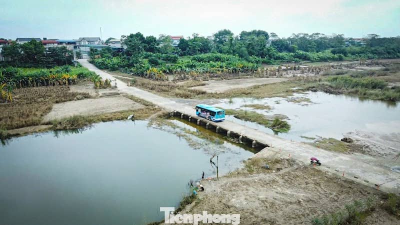
Đập tràn Minh Châu is a low-profile concrete spillway set in Phú Thọ's agricultural landscape — shoot dynamic water flow, repeating geometric lines of the dam, and reflections of surrounding rice paddies. Best after heavy rains for dramatic torrents; golden hour softens concrete and uplands. Accessible by road; small roadside parking and local footpaths; no formal entry fee. Respect local farmers and avoid walking on wet spillway surfaces. Weekday mornings are quieter.
Đ
Đập tràn Minh Châu
Đập tràn Minh Châu is a low-profile concrete spillway set in Phú Thọ's agricultural landscape — shoot dynamic water flow, repeating geometric lines of the dam, and reflections of surrounding rice paddies. Best after heavy rains for dramatic torrents; golden hour softens concrete and uplands. Accessible by road; small roadside parking and local footpaths; no formal entry fee. Respect local farmers and avoid walking on wet spillway surfaces. Weekday mornings are quieter.